Getting started in remote sensing
A few resources for the new user.
I recently launched a new EO platform for anyone who wants data without wanting to deal with coding. You can check it out at accessearthdata.com
Two weeks ago, I spoke in a webinar about building a career in sustainability. The audience was a group of young professionals, navigating their way through school or looking for a job. Many of them had questions about how to gain the skills needed to work in the remote sensing field, and so I wrote this article to provide them with a few resources to get started. Considering that just one year ago, I had no experience in geography or remote sensing, I thought it might encourage a few people to consider the field. All of the resources below are open-source, free to access and available at any time. They’re a great way to introduce yourself to the field before committing to a paid course or degree.
Remote Sensing Tutorials from Natural Resources Canada
Natural Resources Canada has a great series of articles highlighting introductory concepts of remote sensing. They teach you about the electromagnetic spectrum, different types of sensors, and more. Their articles are easy to follow, and you can probably complete a whole chapter within a day.
Link: Natural Resources Canada
NASA Applied Remote Sensing Training Program (ARSET)
I took these courses before I started grad school, and I’m so glad that I did! As someone without any previous experience working in this field, the publicly available NASA ARSET courses were the perfect first step for me. These courses are designed as part of NASA’s capacity-building program. Their goal is to increase accessibility to earth observation data, train new professionals, and increase the use of this data in environmental management and policy decision-making.
Their courses are categorized into different topics, such as “Health & Air Quality”, “Agriculture”, “Water Resources”, and more! Before jumping into any of these topics, I would recommend taking their “Fundamentals of Remote Sensing” course.
Link: NASA ARSET
Google Earth Engine Tutorials by Qiusheng Wu
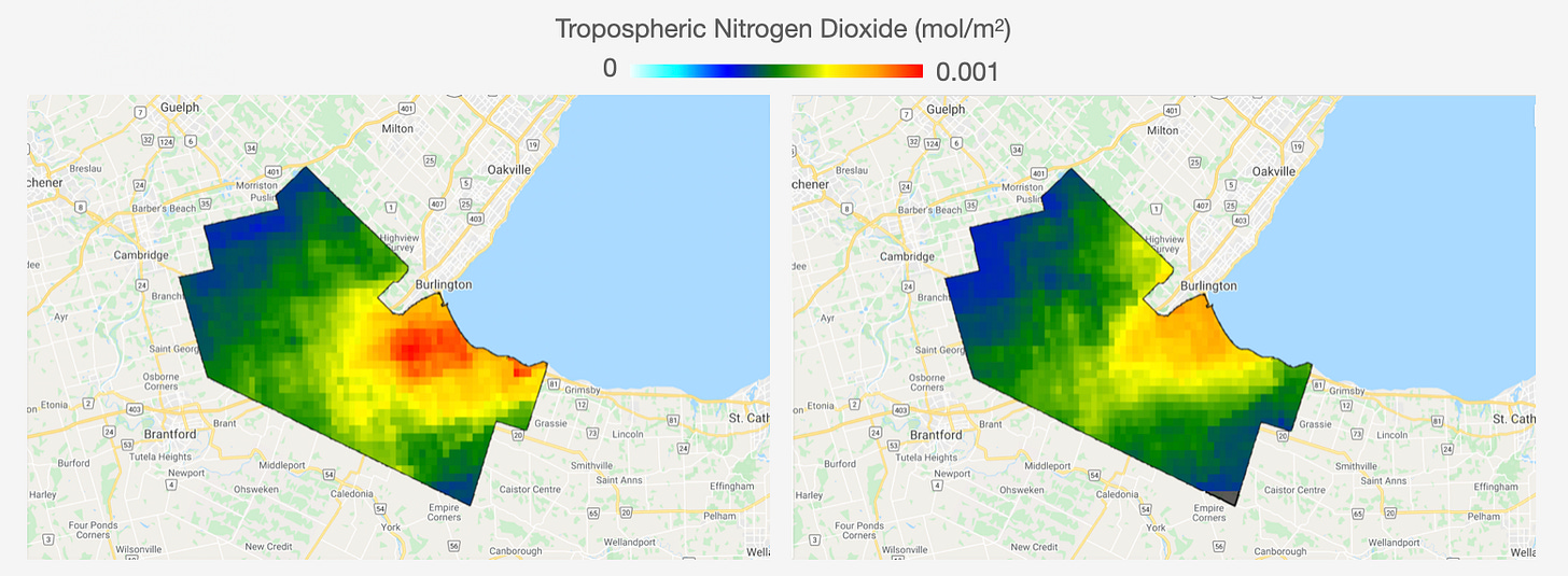
I no longer use Google Earth Engine (GEE) to do my work, as I prefer doing my analysis in R. However, I initially prepared a few images highlighting the differences in nitrogen dioxide columns between 2019 and 2020 (image above) for a presentation earlier this year. The goal was to demonstrate to the audience how COVID-19 had impacted traffic-related emissions across the Hamilton area.
When I started using Google Earth Engine, I found the tutorials prepared by Dr. Wu to be extremely useful. Not only did he prepare tutorials on how to use GEE, but he also created his own Python package! It’s called geemap, and it’s extremely user-friendly and easy to follow. If that wasn’t good enough, he creates and uploads short YouTube tutorials regularly. All of these resources can be found on his main YouTube page.
Link: YouTube
EarthDataScience.org Tutorials
Once you’ve become familiar with the concepts of remote sensing and understand how the data is collected, you can start playing around with different scripting languages to figure out which one is the best fit for you. I personally use a combination of R and Python. If you don’t have previous coding experience, the walk-through tutorials on EarthDataScience.org are a good starting point. They’ve created beginner-friendly tutorials that not only teach you how to work with remote sensing data files, but also how to analyze them using a variety of data science principles.
Link: EarthDataScience
RUS Copernicus
The greatest accelerant in my understanding of satellite remote sensing data processing was through the RUS Copernicus courses. These courses are for people who are a little more comfortable working with netCDF files, and I would recommend going through a few programming tutorials from the links above before jumping into these. However, they bring you up to speed on essentials skills such as regridding, cropping, or aggregating files - essential when you’re working with so many large datasets.
The only downside is that the Python notebooks used in the courses are not available to users outside of the European Union, but it’s easy enough to follow along and you can extract whatever code you need for your work. All of the courses are regularly uploaded onto their YouTube channel.
Link: RUS Copernicus YouTube
Feel free to reach out if you have any questions!


